Trail number
Not applicable
Trail length
25 kilometres (circuit as described)
Elevation variance
260 metres
Trail type
Single trail, 4WD trail, gravel road and bitumen road
Trail surface
Smooth dirt, fine gravel, coarse gravel, rocks and rock outcrops
Weather affected
Prone to be muddy after medium rain
Trail condition sources
Nil
Trail features
Steep 4WD trails with plenty of ruts, river ford, spectacular views along gorge, some mining history
Trail obstacles
Bogs, river ford, very technical sections

Trail rating
Difficult (the gorge section is for experienced riders only)
Rating basis
Estimated
Night riding
No - gorge terrain is difficult and remote and should not be ridden at night
Family Friendly
Definitely not.

Use Topographic Map For This Area
No GPX download
This ride is about 25 kms long and covers a variety of roads, trails and single track. The trail is the light blue trail above using the red trail (Byers Back Track) to complete the loop.
The north western and north eastern legs of the trail are on gravel roads but these can be bypassed by other trails in the area by reference to a topographical map or GPS. Other rides in the Blackwood North section (eg Sweet Nuggs, Yankee Track, Old Backwood Road) can also be used to maximise the off road time as well but the north eastern leg has few options to bypass it.
In a similar manner, you could do Byers Back Track (red), ride up and back on Amblers Track to Chettle Road and then do a bit of hike a bike up Tunnel Point Track (pink) before getting a downhill run home maybe via Shaws Lake area. This would be largely off road.
The route as described by the light blue track starts at the Blackwood pub, heads down Golden Point Road, left onto North Blackwood Road, right onto Chettles Road, down Ambler Lane into the Lerderderg Gorge and then back along the Byers Back Track to Blackwood.
Personally I prefer to ride this circuit in the clockwise direction as there is a large climb from Golden Point Road up to Chettles Road after which the remainder of the circuit is undulating or downhill. This ride is not as steep in sections as the shorter Tunnel Point track route and, hence, is more of a typical cross country nature. The route can be ridden for the whole length with the exception of a very short length out of the Gorge which is easier to walk than ride.
On this ride while taking photos, it took about two hours to complete at an average speed of 13 km/h and a max speed just over 40 km/h. Obviously it would have been a bit quicker if not taking the photos but this gives a rough idea of the time taken.
These trails are in a remote part of the forest so go prepared with additional water and food and be self sufficient in terms of being able to repair your bike.
Beware of snakes in the warmer parts of the year.
If you do get into trouble in the gorge, refer to your map as to the shortest way out. For this ride, if you are on the Ambler Lane, follow the track back to Chettles Road. If on the Byers Back Track section, Gribbles Track provides a quick (but steep) way out to O'Briens Road. Reference to the map that you should be carrying will provide the best source of this information in this area. In the Gorge, there are regular markers showing the distances out of the Gorge.
The following photo gallery has been taken in order from the Blackwood pub heading east through town, onto the North Blackwood Road, Chettles Road, Ambler Lane and then return via Byers Back Track.
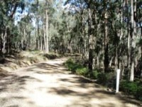
From left to right, Blackwood Pub is the starting point for the ride (you head down Golden Point Road which is where the caravan sign is pointing). Heading east on Golden Point Road towards the mineral springs area, you then head around a slight hairpin bend corner. It was on this hairpin bend that the first gold in Blackwood was discovered - there is a memorial stone coming down the hill just prior to the corner with some information on it).
Around the bend, you come to what remains of the Royal Mail Hotel - the portion on the corner has since been demolished unfortunately. The hotel operated between 1863 and 1913. Keep heading down Golden Point Road until it turns to gravel near the North Blackwood Road turnoff (last photo above). Turn left onto North Blackwood Road.
If you wanted to skirt this on road section you could head up through Shaws Lake via the mineral springs.
 |
 |
 |
|---|---|---|
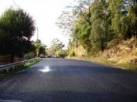
Heading east from the Blackwood Pub along Golden Point Road. |
||
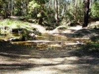
An alternative start point if you wish to reduce the length of the ride, is to start at the intersection of Golden Point and North Blackwood Road as shown in the photo below - there is parking just off Golden Point Road next to the river as shown in the second photo below. This area used to be known as the 'Ford' - presumably before the bridge was put in.
 |
 |
 |
|---|---|---|
Above are pictures of the ford area and the river there. |
||
 |
 |
 |
|---|---|---|
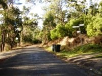
Follow North Blackwood Road from the ford area past the security frog (well actually its now a big giraffe and gorilla) |
||
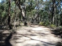
Follow North Blackwood Road from the ford area past the security frog, past the Shaws Lake turn off (you can veer left here to get on the single track section described in the Yankee Track ride or further on you can turn right onto Ruth's Track / Haydens Track as described in the same ride to get to Chettles Road as an alternative to following North Blackwood Road. Alternatively Ruth's Track can be used to connect to the Wombat Track to get onto Chettles Road.
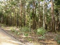
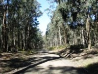
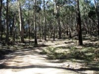
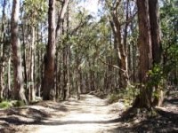
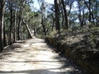
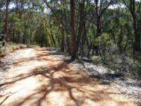
Chettles Road is a relatively easy gravel road to ride and has some nice curves with berms created by vehicle traffic so you can keep up a good pace through the corners.
 |
 |
 |
|---|
 |
 |
 |
|---|---|---|
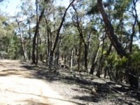
Fast flowy trails heading west across top of loop with small jumps and table tops. |
||
 |
 |
 |
|---|
 |
 |
 |
|---|
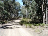
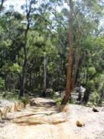
Part way along Chettles Road, the road crosses the imaginatively named Water Creek which is a great little spot for a rest with a nice creek flowing in the cooler months. This is just short of the halfway point of the ride. Water Creek is dry for the greater part of the year so do not rely on it for water.
 |
 |
 |
|---|
 |
 |
 |
|---|---|---|
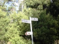
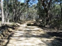
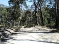
Keep following Chettles Road until you get to the Ambler Lane intersection. |
||
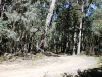
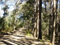
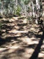
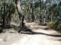
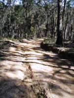
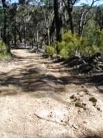
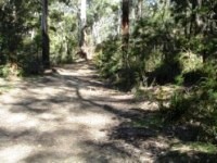
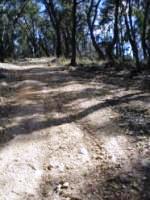
Below is the intersection with Amblers Lane. Amblers Lane is open to vehicles on a seasonal basis and gets pretty chopped up in sections so this is where the interesting riding starts. Keep an ear out for 4WDs and motorbikes. The further on you go, the rougher the trail gets but good speed can still be maintained through these sections and it gradually heads downhill into the gorge.
 |
 |
 |
|---|
 |
 |
 |
|---|
 |
 |
 |
|---|
 |
 |
 |
|---|
 |
 |
 |
|---|
 |
 |
 |
|---|
 |
 |
 |
|---|
 |
 |
 |
|---|---|---|
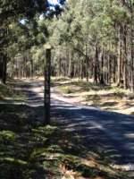
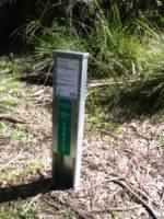
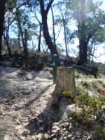
Note the post in the right hand photo. These are placed at regular intervals along the river and provide emergency route information on how to get out of the gorge area. Some also have an historical narrative on local features as appropriate. |
||
 |
 |
 |
|---|
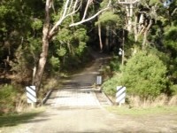
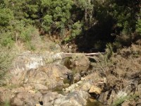
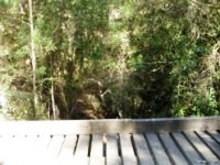
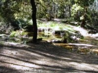
The first photo above shows the ford crossing at the Lerderderg River. It was about 20 cm deep at the time of the photo but could be much deeper in times of recent rainfall. Take care if there has been heavy rainfall. The river should not be crossed if deep or flowing strongly. Most of the time this is not the case. In cold weather, walk the ford as you don't want to take a dip as the water is freezing and you're a long way from home.
 |
 |
 |
|---|---|---|
Climbing out of the gorge - yes the camera was held horizontally to give an idea of steepness. Only a short section though. |
||
 |
 |
|
|---|---|---|
Post located at intersection with Byers Back Track. Head left to O'Brien's Crossing by Byers Back Track, right to Blackwood by Byers Back Track, straight ahead to O'Briens Road |
||
No video available for this trail.
 |
Parking is available at Blackwood town centre or the river on North Blackwood Road. |
|---|---|
 |
Toilet facilities are available at Blackwood (located on hill opposite pub). |
 |
Drinking water is available at the gold stamper opposite the pub. |
 |
Food can be obtained at the Blackwood Pub, Garden of St Erth or Blackwood Provedore (both are good). |
 |
Local area information can be obtained from the noticeboard to the right of the Blackwood Provedore. |